Land Photography
Through a strategic combination of aerial and ground-level imagery, along with detailed property mapping, this package offers a comprehensive visual overview that highlights the unique features and potential of your land.
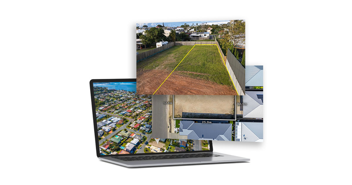
Capturing various angles and perspectives, drone images provide a compelling aerial view of the property, showcasing its layout, surrounding environment, and potential. This broad perspective is invaluable for buyers to understand the property’s scale and its context within the local area.
Ground-level photographs compliment drone imagery by providing detailed views of the land’s topography, vegetation, and any existing structures or features.
Integrating a bird’s eye view with boundary markers and block dimensions offers a clear, detailed map of the property. This inclusion helps buyers visualise the exact size and shape of the lot, aiding in spatial planning and the assessment of its suitability for their specific needs.